Ōtara Creek
Ōtara Creek is a mid-order, low gradient stream. Its origins are heavily modified and largely comprised of industrial and residential areas. The creek flows from Flat Bush and discharges into the Tāmaki River.
The Ōtara Creek Monitor (simple data page / full page): was placed in the creek beside Lovegrove Crescent. After several months of collecting data which sporadically showed extremely high EC readings, suggesting repeated pollution events of short duration, this monitor stopped functioning. The equipment was found to have been removed, so a new monitor was installed.
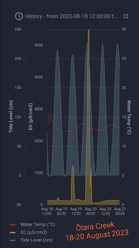
As of August 2023 it has been showing very high EC peak readings again, mostly occuring late Fridays and Saturdays. This might indicate dumping of industrial wastes, and this needs further investigation. As can be seen in the above chart, the EC level remains low during flood tide and then quickly elevates as soon as the tide turns to flow out. This might indicate that the pollution is upstream of the sensor, as the flooding tide is bringing clean water up from downstream, then the waste is flowing from upstream past the sensor on the outgoing tide.